A Clearer View From Above
SkyTech Drone Solutions provides professional aerial data and documentation for businesses across Tennessee. From construction progress and infrastructure inspections to high-resolution mapping and property documentation, we capture the information you need from a perspective that ground-based equipment can't provide.
Our drone services help businesses monitor projects, document assets, identify areas that need attention, and maintain a clear visual record over time. We focus on reliable data, professional results, and straightforward service that helps you make better decisions.
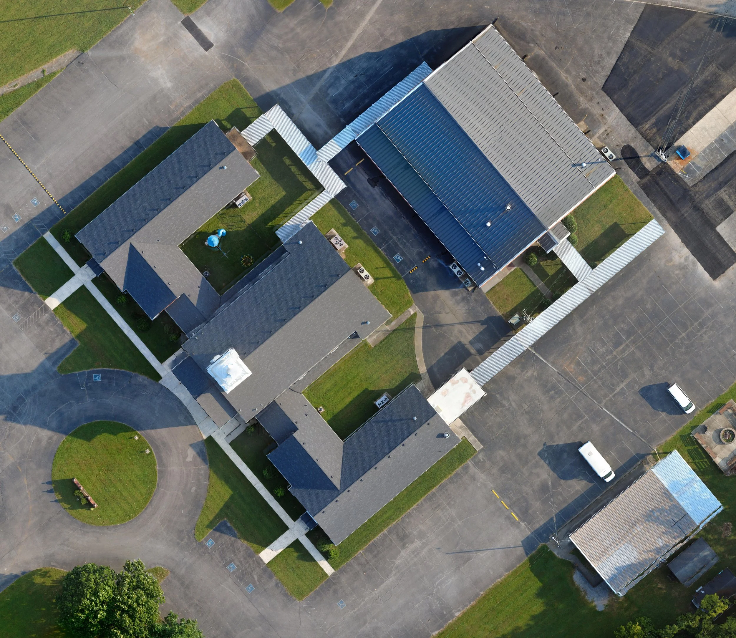
High-Resolution Orthomosaic Mapping
Turn hundreds of aerial images into a single, detailed map of your property, project, or site. Our drone-based orthomosaic mapping provides an accurate overhead view that can help with site documentation, construction progress, land management, planning, and inspections.
Instead of sorting through individual aerial photos, you get one seamless, easy-to-use image that shows the entire area in detail.
Ideal for:
Construction and project documentation
Land and property management
Site planning and development
Agricultural and rural properties
Infrastructure documentation
Before-and-after project comparisons
We capture the imagery from the air and process it into a high-resolution orthomosaic that gives you a clear, comprehensive view of your site.
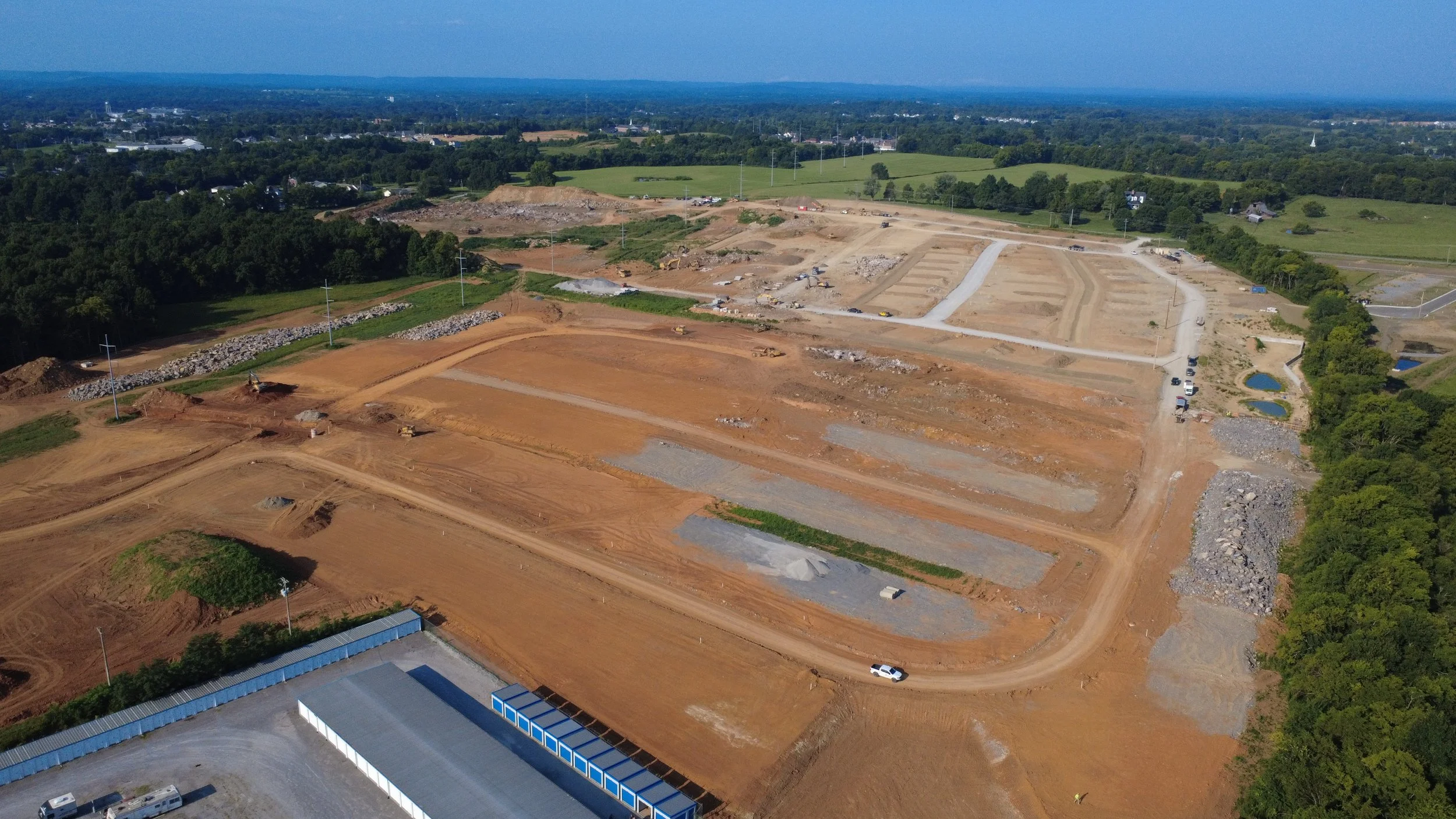
Construction & Stockpile Monitoring
Keep a clear view of your project and materials with professional drone-based aerial documentation.
Construction Progress Monitoring
Regular aerial photography provides a consistent visual record of your construction site as work progresses. Capture site conditions, document completed work, monitor changes, and provide project stakeholders with an easy-to-understand view of progress over time.
Stockpile Monitoring
Keep track of material stockpiles with regular aerial imagery. Document the location, condition, and visible changes of dirt, gravel, sand, rock, mulch, and other bulk materials. Scheduled flights can help you monitor material movement and maintain a visual record of your inventory without relying solely on ground-level observations.
Whether you're managing a construction project or monitoring materials across a large site, SkyTech Drone Solutions provides clear, consistent aerial documentation that helps you stay informed.
Volume measurements and detailed stockpile calculations available as additional mapping capabilities are added.
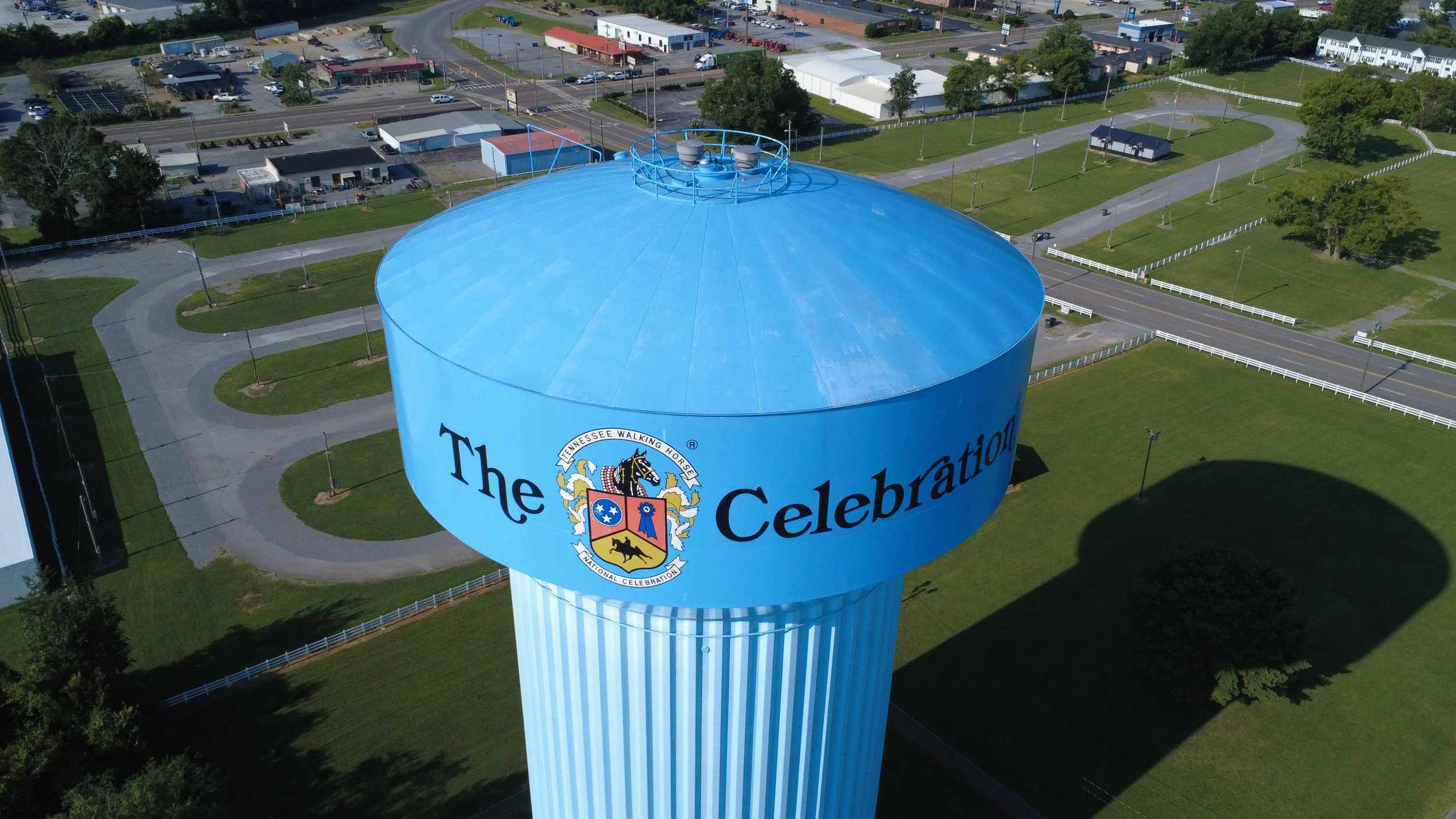
Infrastructure Inspections
Get a closer look at critical infrastructure without putting your team in unnecessary danger. SkyTech Drone Solutions uses high-resolution aerial imagery to document infrastructure and identify visible conditions that may require further inspection.
Our drone-based inspections can help document:
Cell towers and communications infrastructure
Water towers and storage tanks
Bridges and elevated structures
Utility infrastructure
Rooftops and other difficult-to-access areas
Aerial inspections provide detailed visual documentation of hard-to-reach areas while reducing the need for ladders, lifts, or other access equipment. Images and video can be used to document existing conditions, track changes over time, and help maintenance teams determine where closer inspection may be needed.
Regular inspection flights can also provide a visual history of an asset, making it easier to compare conditions over time and document maintenance or repairs.
Let’s Talk About Your Project.
Have a project that could benefit from a professional aerial inspection, construction documentation, or drone photography? Tell us a little about what you need, and we’ll get in touch to discuss your project and how SkyTech Drone Solutions can help.